

Leases Approval Tribunal: 17 December 2025
PUBLIC NOTICE NOTICE is hereby given that a Sitting of the Leases Approval Tribunal (LAT) will be held on WEDNESDAY THE 17 DECEMBER 2025 AT 9.00AM at the Courtroom, Avarua, […]
Read More
PUBLIC NOTICE NOTICE is hereby given that a Sitting of the Leases Approval Tribunal (LAT) will be held on WEDNESDAY THE 17 DECEMBER 2025 AT 9.00AM at the Courtroom, Avarua, […]
Read More
The Public is hereby advised that the High Court (Land Division) will sit at Court House, Rarotonga on Thursday 11th December 2025 at 1pm tohear and determine the following applications […]
Read More
PUBLIC NOTICE The Public is hereby advised that the High Court (Land Division) will sit at Court House, Arutanga, Aitutaki on Monday 15th December 2025 at 9am until Thursday 18th […]
Read More PUBLIC NOTICE The Public is hereby advised that the High Court (Land Division) will sit at Court House, Rarotonga on Monday 08th December 2025 at 9am and 1pm until Thursday […]
Read More
PUBLIC NOTICE NOTICE is hereby given that a Sitting of the Leases Approval Tribunal (LAT) will be held on FRIDAY THE 21 NOVEMBER 2025 AT 9.00AM at the Courtroom, Avarua, […]
Read More PUBLIC NOTICE NOTICE is hereby given that a Sitting of the Leases Approval Tribunal (LAT) will be held on FRIDAY THE 24 OCTOBER 2025 AT 9.00AM at the Courtroom, Avarua, […]
Read More Rarotonga – PUBLIC NOTICE The Public is hereby advised that the High Court (Land Division) will sit at Court House, Rarotonga on Thursday 30th October 2025 @ 9am to hear […]
Read More
PUBLIC NOTICE The Public is hereby advised that the High Court (Land Division) will sit at Court House, Arutanga, Aitutaki on Thursday 23th and Friday 24th October 2025 at 9am […]
Read More
PUBLIC NOTICE The Public is hereby advised that the High Court (Land Division) will sit at Court House, Rarotonga on Monday 20th to Wednesday 22nd of October and Tuesday 28th […]
Read More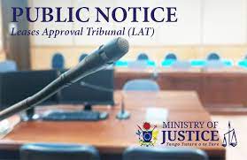
PUBLIC NOTICE NOTICE is hereby given that a Sitting of the Leases Approval Tribunal (LAT) will be held on FRIDAY THE 26 SEPTEMBER 2025 AT 9.00AM at the Courtroom, Avarua, […]
Read More